Slope engineering in Wolverhampton encompasses the assessment, design, and stabilisation of natural and man-made inclines to prevent ground movement and ensure long-term safety. The city's varied topography, shaped by its industrial past and urban expansion, means that slopes are not just rural concerns but integral to residential, commercial, and infrastructure projects. Whether it's a cutting for a new access road, a retained garden on a hillside property, or the remediation of a former quarry face, understanding slope behaviour is critical. This category covers the full spectrum of geotechnical input, from initial desk studies and ground investigation to detailed design and construction monitoring, ensuring that every slope remains stable under both static and dynamic loading conditions.
Wolverhampton's underlying geology plays a defining role in slope behaviour. The area sits predominantly on Carboniferous Coal Measures, comprising interbedded sandstones, siltstones, mudstones, and coal seams, often overlain by glacial till and head deposits. These strata are notoriously variable in strength and permeability, creating complex groundwater regimes that can significantly reduce effective stress and trigger instability. In particular, the presence of weathered mudstone horizons and relict shear surfaces within the superficial deposits demands rigorous slope stability analysis to identify potential failure mechanisms. Without this local understanding, even modest excavations can encounter unexpected ground conditions that compromise safety and programme.
All slope works in the UK must comply with the hierarchy of standards led by Eurocode 7 (BS EN 1997-1 and -2) and its UK National Annex, which governs geotechnical design. For slopes specifically, BS 6031:2009 provides the code of practice for earthworks, while CIRIA guidance such as C758 and C760 offers best practice for asset management and debris flow risk. Where slopes affect the public highway, the Design Manual for Roads and Bridges (DMRB) CD 622 and CD 641 become relevant, and any work near watercourses may require Land Drainage Act consents from the Lead Local Flood Authority. These standards mandate a limit state design approach, ensuring that both ultimate and serviceability requirements are met, with appropriate factors of safety verified through calculation and observation.
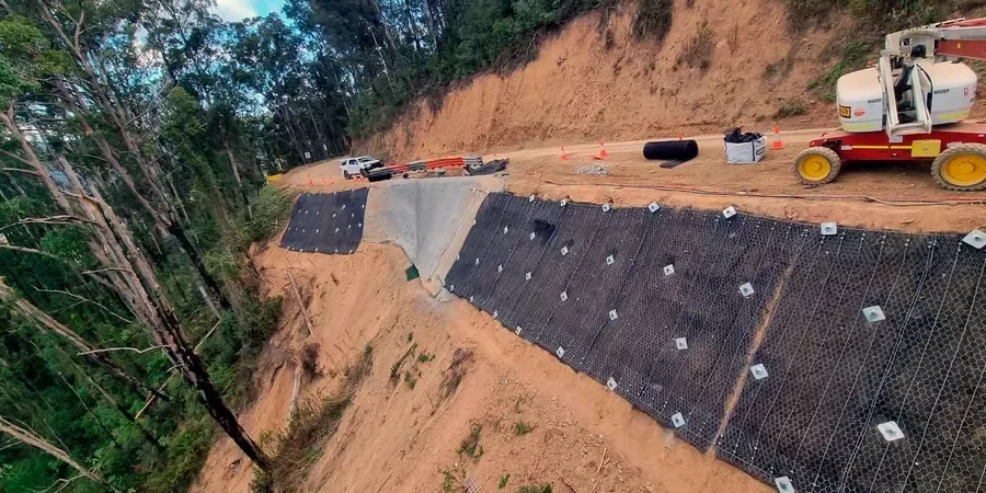
The types of projects that demand specialist slope input are diverse. Residential developments on the city's fringes often require cut-and-fill earthworks and permanent retaining wall design to create level plots. Infrastructure schemes, such as the Midland Metro extensions or highway widening along the A449, frequently involve steepened cuttings that need reinforcement. In former mining areas, slopes may require active/passive anchor design to restrain unstable blocks or supply global stability where space is limited. Even smaller-scale projects like school playing fields or attenuation ponds can trigger the need for slope assessment if they alter existing gradients or drainage paths.
Common questions
What are the typical signs of slope instability I should look for on my property in Wolverhampton?
Common indicators include tension cracks in the ground, leaning or displaced retaining walls, bulging at the base of a slope, water seepage, and sudden changes in vegetation. Tilting fence posts, cracked paving, or doors and windows that begin to stick can also suggest ground movement. If you observe any of these, you should commission a geotechnical assessment promptly, as early intervention is almost always more cost-effective than major remedial works.
Do all slope works require planning permission and building regulations approval?
Not necessarily, but many do. Minor landscaping may fall under permitted development, but significant regrading, retaining structures over 1m high near boundaries, or works affecting protected trees or drainage will typically require planning permission. Structural retaining walls must also comply with Building Regulations Part A. For larger schemes, an Environmental Impact Assessment may be triggered, and early consultation with City of Wolverhampton Council planners is always recommended.
How long does a typical slope stability assessment take, and what does it involve?
A desk study and walkover survey can often be completed within two to three weeks. If intrusive ground investigation is needed—such as boreholes or trial pits with laboratory testing—the full assessment may take six to eight weeks. The process includes defining the ground model, selecting design parameters, and performing limit equilibrium or numerical analysis to calculate the factor of safety against failure. Reporting follows, with recommendations for any necessary mitigation.
What is the difference between active and passive anchors for slope stabilisation?
Active anchors are tensioned after installation to apply a predetermined load to the ground, immediately mobilising resistance and limiting movement. Passive anchors, also known as soil nails, are not tensioned and only develop force as the ground deforms. Active anchors are often used where strict deflection control is required, such as near sensitive structures, while passive systems suit general slope reinforcement where some deformation is acceptable.
Location and service area
We serve projects across Wolverhampton and surrounding areas.