BS 5930:2015 + A1:2020 sets the standard for ground investigation in the UK, and in Wolverhampton that means seismic tomography must account for more than just soil. The city sits on the South Staffordshire Coalfield and overlies a complex sequence of Carboniferous sandstones, mudstones, and coal measures, cut by faults like the Russell's Hall Fault. Refraction and reflection surveys here routinely need to distinguish natural rockhead from buried mine entries or collapsed workings. We run these surveys to map subsurface velocity contrasts, which feed directly into Eurocode 7 design profiles. When a site is near old bell pits off the Cannock Road or in areas with known shallow workings, a seismic refraction line combined with targeted test pits helps tie geophysical anomalies to physical ground truth before any earthworks begin.
Seismic velocity cross-sections reveal what boreholes miss: the lateral continuity of rockhead, voids, and buried channels across a site.
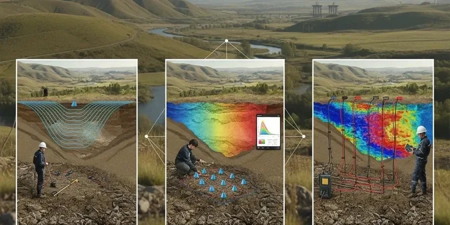
Method and coverage
Regional considerations
Wolverhampton's population of over 260,000 lives and works above one of the most heavily mined coalfields in the UK. The Coal Authority's interactive map shows hundreds of recorded mine entries within the city boundary, and many more unrecorded shafts exist. Seismic tomography mitigates the direct risk: a void or collapsed pillar creates a low-velocity anomaly that a well-designed refraction line will image before an excavator finds it the hard way. On a recent project near Wednesfield, a reflection survey identified a 3-metre void at 12 metres depth that desk study alone had not flagged. The cost of missing that would have been a piling rig stuck in a collapse, weeks of delay, and a dangerous site condition. In karst-prone limestone bands within the Pennine Middle Coal Measures, similar velocity drops can indicate solution features. We configure the survey to catch these hazards because the consequence of not doing so is never just financial.
Standards that apply
BS 5930:2015 + A1:2020, Eurocode 7 – BS EN 1997-2:2007, ASTM D5777-18 (geophysical site characterization)
Complementary services
Seismic Refraction Tomography
Best for rockhead profiling and void detection down to 15–20 metres. Fast deployment on compact sites. We use multi-shot arrays and damped least-squares inversion to resolve velocity gradients in the drift and bedrock.
Seismic Reflection Profiling
Applied when targets exceed 20 metres depth, such as imaging deep coal seams, fault planes, or abandoned mine roadways. Requires careful source-receiver geometry and CDP processing to suppress ground roll in urban noise environments.
Typical parameters
Top questions
What does a seismic tomography survey cost in Wolverhampton?
For a typical refraction line in Wolverhampton, survey cost ranges from £1,930 to £3,910 depending on spread length, number of shots, and access constraints. Reflection surveys with deeper targets and higher channel counts sit at the upper end. We provide a fixed-price quote after reviewing the site plan and target depth.
Can seismic tomography detect old mine workings in Wolverhampton?
Yes. Voids and collapsed workings produce clear low-velocity anomalies in a refraction tomogram. We correlate these with Coal Authority records and, where needed, verify with targeted drilling. The method is especially effective in the sandstone and coal measure sequences beneath the city.
How long does a seismic survey take on site?
A single refraction line with a 2-person crew normally takes half a day to set up, shoot, and demobilise. Reflection lines or multi-line grids take longer. Processing and interpretation add 3–5 working days before the report is issued.
What surface conditions work for seismic tomography?
Compacted gravel, asphalt, short grass, and firm soil all work well. Loose fill, deep mud, or standing water attenuate the signal. In Wolverhampton's brownfield sites we sometimes need to clear rubble or compact the shot point to get clean first arrivals.